

[Musealia : Aerial photographs that tell the story of the Sorbonne's "flying classes"]
Every month, Sorbonne University invites you to discover an object from its heritage collections. This month, discover aerial photographs that tell the story of the Sorbonne's "flying classes".
In 1959, an article published in the magazine France Aviation welcomed an educational innovation that had awakened the "old Sorbonne", which was now "up to date" with an " up to date teaching technique": teaching geology by plane. "This small revolution in academic traditions," the journal added, "is the work of a First World War aviator: Jean Gandillot, today a reserve lieutenant-colonel in the French Air Force, lecturer in photogeology in the Faculty of Science, whose flight logbook, opened in 1918 when he commanded a photo section equipped with Salmson biplanes, now totals more than 3,000 hours, including those he flew during the Second World War.
Launched in 1950, the initiative lead students from the Faculty of Science to Le Bourget, where, boarding Air Transport planes, they took part in a 'flying class' lasting about three hours 'with all the more enthusiasm as, for many of them, this celestial excursion was also a baptism of air'. A pioneer in the application of aerial observation and photography to geography, geology, ethnography and archaeology, Gandillot was widely acclaimed for this pedagogical innovation, to the point that his initiative was included in books such as L'Aviation des temps modernes (Aviation of modern times) (Edmond Blanc, 1953) or The Explorations au vingtième siècle (The 20th century explorations) (Henry Beaubois et alii, 1960).
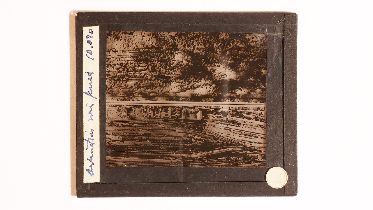
A set of photographic plates on glass was found a few years ago in the reserves of the Pierre and Marie Curie campus. Preserved in a wooden box bearing the name of Lieutenant-Colonel Gandillot, these aerial photographs echo his military career. Representing bombed communication routes, bridges, anti-aircraft batteries, artillery positions or destroyed buildings, they remind us that, since 1918 and before becoming a "photogeologist", Jean Gandillot was a specialist in the interpretation of aerial photographs for military intelligence purposes.
The Scientific and Heritage Collections Unit of the Sorbonne University Library works on the mapping, conservation and promotion of university collections. They include numerous photographic documents, covering a wide range of typologies (autochromes, photographic plates, Lippmann interference plates, etc.), which are gradually being inventoried and reconditioned, in tandem with the university's Archives and Document Collecting Service (SARA).
By Stéphane Jouve, Head of the Geosciences collections and Rémi Gaillard, Head of Scientific and Special Collections Department (BSU)
Source : Archives Pathé Gaumont, TV news from July 23, 1951
Data sheet
- Name : set of aerial photographic plates on glass
- Type de document : photographic plates on glass
- Inventory number : SU.PAL.2022.0.50.3.318.0
- Date : first half of the 20th century
- Place of storage : Sorbonne University's geoscientific collections
Bibliography
-
Jean Gandillot, « La photographie aérienne au service de la géologie », Bulletin de la Société Géologique de France, 1954.
-
Jean Gandillot, La photographie aérienne appliquée aux recherches géologiques, thèse soutenue en 1955 à la Faculté des sciences de Paris.
-
Henry Beaubois, « L’avion au service de la géographie et de la géologie », France aviation, n° 51, février 1959.
Find here all the articles of Musealia.
