

[Musealia : The geological and mineralogical map of the Aveyron department]
Every month, Sorbonne University invites you to discover an object from its heritage collections. This month, discover the geological and mineralogical map of the Aveyron department.
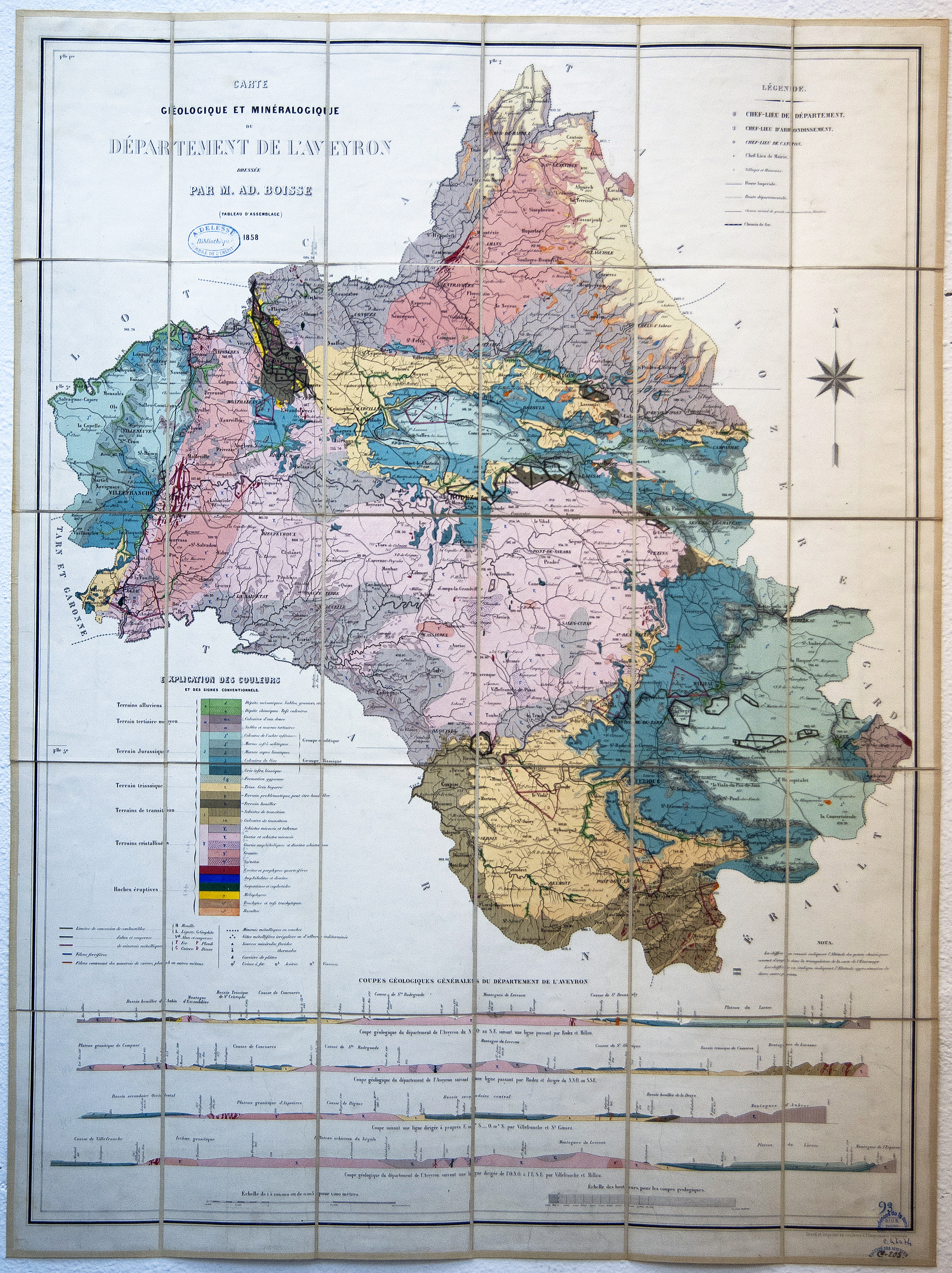
This map belongs to the old collection of the Geosciences and Environment library. It was donated by the Institut de France, which was the custodian of the collection of Achille Delesse (1817-1881), geologist and President of the French Academy of Sciences.
In 1825, the project to draw up a general geological map of France at a scale of 1:500,000 became a reality.
The departmental geological maps were published between this date and 1875 at the request of Victor Legrand, Under-Secretary of State, who entrusted the prefects with their production and the expenses inherent in their execution.
They respond to a double political will: national and local in order to increase local economic development, both industrial and agricultural.
It was in this context that Adolphe Boisse, a native of Rodez, a mining engineer and member of the Geological Society of France, drew up the “geological and mineralogical map of the Aveyron department” in 1858. The first geological map of this department, it presents descriptions of the coalfields and general geological sections.
This map illustrates his memoir “Recherches sur le gisement des minerais métalliques dans l'Aveyron” (Research into the deposit of metal ores in Aveyron), in which he draws up an inventory of the department's mineral wealth, which would enable the development of a prosperous industry, but also "to know the happy influence that the mixture of the soil [...] exerts on cereals and other products of the plant kingdom".
He was asked by the Central Agricultural Society of Aveyron to appraise a piece of land containing "marl layers likely to be usefully employed".
Although the departmental geological maps are now obsolete due to their lack of standards, they nevertheless constitute a part of the history of geology.
Data sheet
- Name / type : Carte géologique et minéralogique du département de l’Aveyron drawn up by M.A. Boisse (assembly table). Engraved and printed in colour at the Imperial Printing Office
- Call number : CAR 6164
- Description : 97 x 70 cm, folded 19 x 12 cm. Scake: 1 200 000
- Date: 1858
- Place of storage : Bibliothèque de Géosciences et environnement
Bibliography
- Pierre Savaton. Les cartes avant les cartes. Les cartes géologiques départementales : la première cartographie détaillée de la France. Travaux du Comité français d’Histoire de la Géologie, Comité français d’Histoire de la Géologie, 2003, 3ème série (tome 17), pp.53-74. Hal-00916789
- Archives départementales de l’Aveyron. « Journal de l’Aveyron » du 07/04/1858 [en ligne] https://archives.aveyron.fr/archives-en-ligne/n:21 (consulté le 1er avril 2022)
- « Recherches sur le gisement des minerais métalliques dans l’Aveyron » par M. Ad Boisse.1858. [en ligne] https://gallica.bnf.fr/ark:/12148/bpt6k9616877q?rk=21459;2 (consulté le 25 mars 2022)
Find here all the articles of Musealia.
